FLUXES

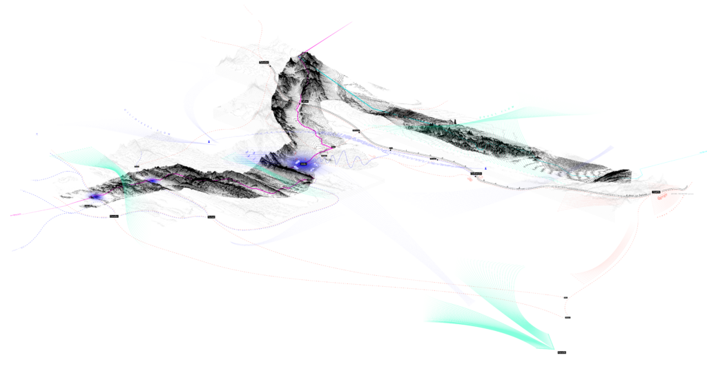
To seize the range and complexity of different locations and actions summing up into the smuggling phenomenon, multiple mappings were made. The first one presents smuggling as a system on a regional scale. It distinguishes the three most essential flows: people, drugs, and oil smuggling. It indicates the origin, critical points of each route and their destinations, varied by a particular type of good. Drugs (represented by green color) penetrate Pakistan from Afghanistan and then transit to Iran at two main gates; the rest is disseminated into the entire country up to Karachi. People trafficking (orange) is based on refugees smuggled either by individual cars or buses and couches. Oil and diesel smuggling (blue) is what creates the economy of Balochistan. The oil arrives from Iran, where its price is usually approximately 50% lower than that of Pakistan. It is either smuggled to Pakistan by local families living in border towns or by big mafias operating mainly in the Jodar area. The oil is then either distributed across the entire country or departs further from the Gwadar seaport, usually to Muscat and Somalia.

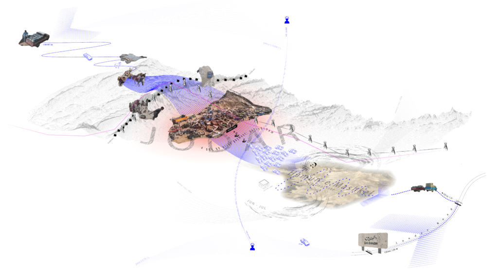
The Jodar area became an exemplary case study of how smuggling is operating on the local scale. The mapping of this location concerns the most representative oil smuggling route, which is used mainly by the biggest oil mafias. It illustrates the consecutive steps that sum up the smuggling process: remote orders, smugglers’ groups formation, departing from villages located by the road such as Dalbandin village, driving the locally famous London Road (the name refers to the fact that the road leads to the western Pakistan border and then abroad), entering the desert of Hamun-e-Mashkel, queuing to enter the Jodar market, bribing frontier corps, and finally committing trades with other smugglers who arrived from the other side of the border, carrying oil barrels with their donkeys and blue pickups on the mountainous path.

